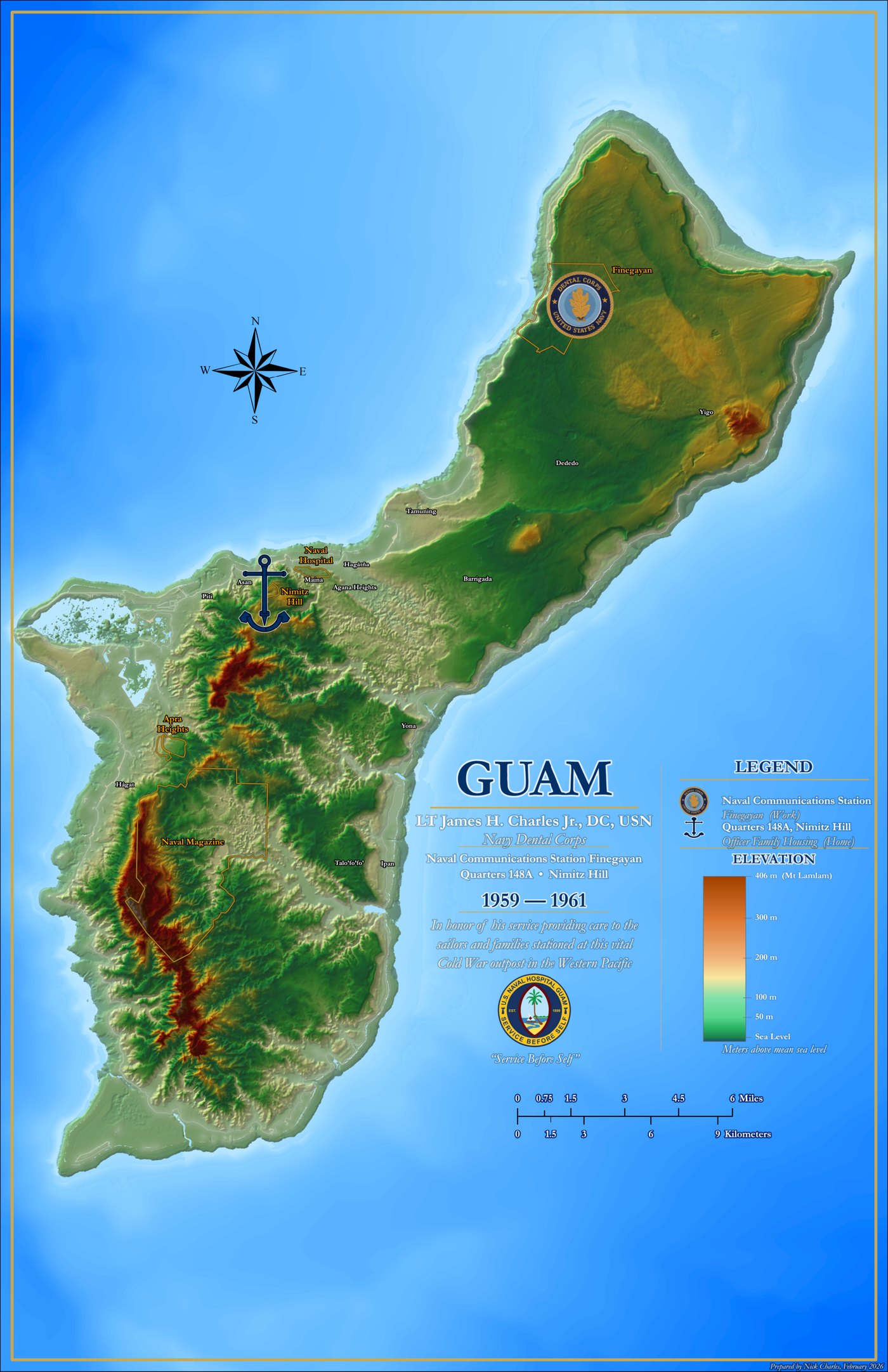
Detail of a relief map of Guam with hypsometric tinting and hillshaded mountain terrain

GIS & Visualization

Large-Format Relief Cartography

Personal print-cartography project: an 11×17 commemorative relief map of Guam with custom hypsometric tinting, hillshaded terrain, bathymetric ocean styling, and hand-placed typography. Click the image for the full map.

Cartography Hillshade Hypsometric Tints Print Design

GIS & Visualization

Multi-Zone Potentiometric Surface Mapping

Built potentiometric surface maps for three hydrogeologic zones at a confidential industrial facility, integrating surveyed well elevations into a centralized geodatabase with cross-sections illustrating vertical gradients and plume migration pathways.

ArcGIS Pro Surfer Hydrogeology Cross-Sections

GIS & Visualization

Superfund Site GIS Modernization

Migrated legacy map documents to ArcGIS Pro for a federal Superfund site, rebuilding geodatabases with updated well surveys and producing standardized potentiometric and plume figures for long-term monitoring reports.

ArcGIS Pro Data Migration Plume Mapping

GIS & Visualization

Site Forensics & Spatial Correlation

Supported a multi-site forensic investigation by normalizing decades of historical records into structured datasets, then spatially correlating historical features, release points, and migration pathways into exhibits for allocation and litigation strategy.

Georeferencing Data Forensics Litigation Support

Data Management

CCR Compliance Database & Statistics

Led the initial EQuIS implementation for a coal combustion residuals groundwater program -- facility setup, valid-values governance, and statistical modules for trend analysis, prediction limits, and exceedance flagging in semi-annual compliance reporting.

EQuIS CCR Rule Statistics Crosstabs

Data Management

Legacy Data Migration to EQuIS

Modernized data management for a legacy landfill by converting years of historical records from an ESDat system into a fully functional EQuIS facility, with semi-annual EDD intake workflows and automated screening logic for action-level exceedances.

EQuIS ESDat Data Migration QA/QC

Data Management

Multi-Facility PFAS Reporting Pipeline

Managed EPA Method 1633 PFAS datasets across a landfill portfolio in EQuIS: EDD validation, consistent non-detect policy, and parameterized crosstab reports with embedded screening logic, producing regulator-ready submittal packages on semi-annual cycles.

EQuIS PFAS EPA 1633 Regulatory EDDs

Field & Web Apps

100-Well PFAS Characterization Support

Supported PFAS characterization at a confidential manufacturing facility -- sampling and synoptic gauging across nearly 100 wells -- and digitized the drilling and well-construction field forms, eliminating manual data entry across multiple mobilizations.

PFAS gINT Groundwater Digital Forms

Field & Web Apps

Remote Stream Telemetry Network

Installed and wired solar-powered stream monitoring stations -- multiparameter sondes, pressure transducers, and auto samplers on cellular telemetry -- for a long-term turbidity program, and built the mobile mapping and field forms used to manage them.

Telemetry Field Maps Water Quality AGOL

Field & Web Apps

Digital Inspections with Automated Reporting

Built Survey123 inspection forms with health scoring for remediation planting programs, plus a Python pipeline that converts each field export into finished deliverables -- results workbooks, photo logs, and 100+ per-asset inspection reports generated in a single pass.

Survey123 Python Automation Report Templates

Field & Web Apps

Sub-Meter GNSS Field Workflows

Configured and deployed high-accuracy GNSS receivers with ArcGIS Field Maps across multiple projects -- offline map packages, control point layers, QA/QC protocols, and step-by-step guides that let field teams collect sub-meter data without a GIS analyst on site.

GNSS Field Maps Offline Maps Training

Due Diligence

Nationwide Phase I ESA Program

Served as primary consultant and task manager for 80+ Phase I Environmental Site Assessments supporting real estate transactions -- ASTM E1527 records review, site reconnaissance, and REC determinations delivered on transaction timelines across 15+ states.

ASTM E1527 Phase I ESA Task Management

Due Diligence

Vapor Intrusion Phase II Investigations

Planned and executed sub-slab vapor and temporary-well investigations at occupied commercial properties -- helium leak testing, TO-15 sampling, and screening-level evaluations delivering decision-ready findings under strict transaction deadlines.

Phase II ESA Vapor Intrusion EPA TO-15

Remediation & Compliance

Voluntary Remediation Program Management

Project manager for a rail facility in a state voluntary remediation program: owning scope, schedule, and budget across multimedia sampling cycles, LNAPL gauging, agency coordination, and a standardized Survey123-to-EQuIS data architecture for defensible reporting.

Project Management LNAPL EQuIS Agency Coordination

Remediation & Compliance

CERCLA Remedial Investigation Field Leadership

Multi-year field lead at a CERCLA site: sampling events spanning 60–100 wells and seeps, custom Survey123 field forms, slug testing, a 14-week biosparging pilot test, and a storm-response scope that restored the monitoring network after a major hurricane.

CERCLA Survey123 Pilot Testing Field Leadership

Have a Similar Project?

Let's discuss how geospatial technology can support your environmental work.

Get in Touch